· deep dive · 12 min read
When Washington Closes the Shutter
Planet Labs just agreed to indefinitely withhold satellite imagery of the Middle East at the U.S. government's request. It's not the first time Washington has blinded commercial eyes in orbit - and the playbook is older than most people realize.
When Washington Closes the Shutter
On April 4, 2026, Planet Labs sent an email to its customers that read like a corporate apology letter drafted by lawyers who’d been up all night. The company would “indefinitely withhold” satellite imagery of Iran and the broader Middle East conflict zone, retroactive to March 9. The reason: the U.S. government had asked - not ordered, asked - commercial satellite providers to stop publishing pictures of a war it was fighting.
The phrasing matters. Planet didn’t say it was forced. It said the government had requested providers “place an indefinite hold on publishing images from the conflict zone.” The company framed its compliance as a balancing act between stakeholders, calling the situation “extraordinary circumstances.” But for journalists, OSINT analysts, and humanitarian organizations that rely on Planet’s near-daily global coverage to independently verify what’s happening on the ground, the effect is the same regardless of the verb choice: the lights went out.
This isn’t a story about one company’s customer service policies. It’s about what happens when the commercial satellite industry - built on the promise of transparency and open data - runs headlong into the reality that its biggest customer is also the entity most capable of telling it to shut up.
And it’s happened before. More than once.
The Escalation
The blackout didn’t arrive all at once. It crept in, like a publication delay that forgot to stop delaying.
On March 6, roughly a week after U.S. and Israeli forces began striking Iranian targets, Planet Labs announced a 96-hour delay on new imagery collected over the Gulf states. The company’s rationale: near-real-time pictures could be exploited to “endanger allied, NATO, and civilian personnel.” Fair enough. A few days’ lag between collection and publication is a defensible compromise.
Then 96 hours became 14 days. Planet extended the delay last month, covering Iran, the Persian Gulf, U.S.-allied bases, and what it called “existing conflict zones.” The geographic scope was broad, the justification thinner. A two-week delay doesn’t just slow verification - it functionally kills it for fast-moving military operations. By the time an image becomes available, the story it would’ve told is already two news cycles old.
Now even that window is gone. Under the new “managed access model,” Planet withholds all SkySat (sub-meter) and PlanetScope (3-5 meter) imagery from its public platforms. Customers can request access on a “case-by-case basis” for what the company deems “mission-critical requirements or in the public interest.” Who decides what qualifies as mission-critical? Planet hasn’t said. Who defines the public interest? Also unclear. The policy is expected to remain in effect until the conflict ends - which, given how these things tend to go, is not a date anyone should pencil in.
Planet isn’t acting alone. Vantor (the company formerly known as Maxar Technologies, in case you lost track of the rebrand) told Reuters it hadn’t been directly contacted by the government but was already implementing its own “enhanced access controls.” The company has long reserved the right to limit image sales during geopolitical conflicts, and it’s applying those restrictions across parts of the Middle East. BlackSky, the third major U.S. commercial imagery provider, has stayed quiet.
The Ghost of Ikonos
If this all feels familiar, it should. The U.S. government has been managing commercial satellite imagery during wartime for a quarter century, and it’s gotten increasingly creative about how it does it.
The first real test came on October 7, 2001 - the same day U.S. air strikes began in Afghanistan. The National Imagery and Mapping Agency (NIMA, now the NGA) signed an exclusive contract with Space Imaging, the company that operated the Ikonos satellite, at the time the only commercial platform capable of one-meter resolution. Under the deal, NIMA purchased sole rights to all Ikonos imagery of Afghanistan collected after September 11. The price was north of $1.9 million for initial coverage. Space Imaging’s government affairs director called it “a wonderful business transaction.”
It was also, functionally, a blackout. NIMA didn’t need to invoke shutter control - the regulatory power that lets the government physically command a satellite to stop imaging a specific area. Instead, it simply bought every picture before anyone else could. News organizations, NGOs, and researchers were locked out, not by law but by a purchase order. Reporters Without Borders called it “disguised censorship.” The Pentagon called it a procurement decision.
The elegance of the buy-to-deny strategy was that it created no legal injury anyone could challenge in court. Space Imaging was fulfilling a lucrative contract, not being silenced. There was no gag order to fight. By the time the exclusive deal expired months later, the early phase of the war - when independent imagery would’ve been most valuable - was over.
Land Remote Sensing Policy Act
Establishes licensing framework for commercial satellite imaging. Includes shutter control provisions allowing the government to restrict operations for national security.
Presidential Directive 23
Clinton signs PD-23, formalizing shutter control, blackout zones, and distribution control for U.S.-origin commercial satellite imagery.
Kyl-Bingaman Amendment
Congress prohibits U.S. companies from distributing satellite imagery of Israel at resolutions higher than available from non-U.S. sources. The only country-specific imagery restriction in U.S. law.
Afghanistan Buy-to-Deny
NIMA purchases exclusive rights to all Ikonos imagery of Afghanistan, creating a commercial blackout without invoking shutter control.
Kyl-Bingaman Relaxed
NOAA drops Israel imagery resolution limit from 2 meters to 0.4 meters after acknowledging that twelve companies in eight countries already offer superior resolution.
96-Hour Delay Imposed
Planet Labs implements initial delay on Middle East imagery following the start of U.S.-Israeli strikes on Iran.
Delay Extended to 14 Days
Planet expands the delay to two weeks, significantly limiting OSINT verification of the conflict.
Indefinite Blackout
Planet Labs announces managed access model, withholding all imagery retroactive to March 9 for the duration of the conflict.
Why 2026 Is Different from 2001
The Afghanistan buy-to-deny worked because the commercial satellite market in 2001 was tiny. Ikonos was essentially the only game in town for high-resolution commercial imagery. Buy one satellite’s output, and you’ve bought the market.
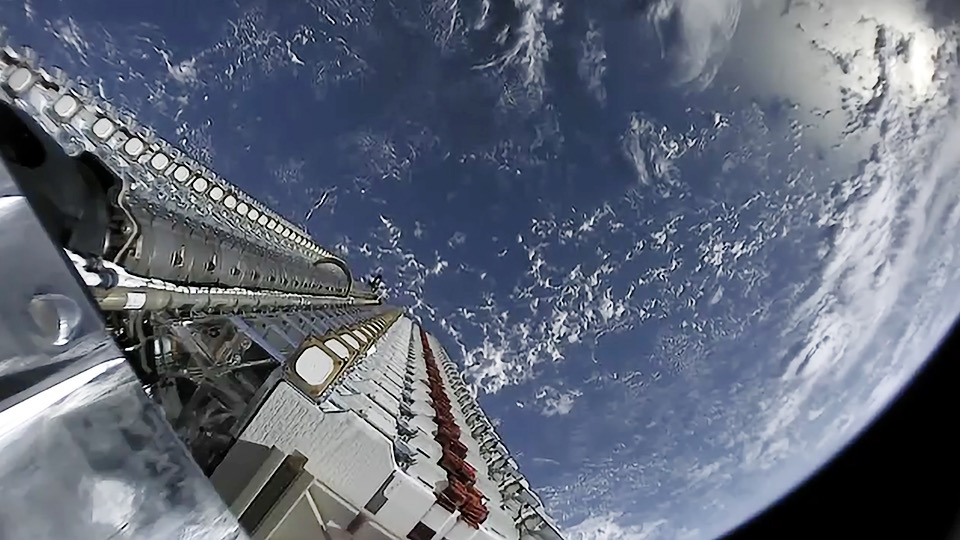
That approach would be wildly impractical today. Planet alone operates over 200 satellites across multiple constellations - its Dove CubeSats deliver 3-5 meter resolution imagery of every landmass on Earth every day, while its SkySat fleet provides sub-meter imagery with multiple daily revisits. Add Vantor’s WorldView and Legion satellites, BlackSky’s growing Gen-3 constellation, and a half-dozen other commercial providers, and the sheer volume of orbital cameras pointed at the Middle East makes a buy-to-deny approach financially absurd. Defense analyst Todd Harrison noted this exact problem back in 2023 during the Gaza conflict, pointing out that the proliferation of commercial providers makes it “complicated and logistically difficult to just buy up everything on the market.”
So instead of buying the imagery, the government asked providers not to sell it. The shift from a financial mechanism to a regulatory-adjacent request represents a significant evolution in how Washington manages commercial space data during wartime. It’s less elegant than the 2001 approach, but it covers more ground.
The catch is that it only covers American ground. Planet Labs, Vantor, and BlackSky are all U.S. companies operating under NOAA licenses. European, Asian, and other international providers operate under no such constraints.
The Shifting Playbook
| Afghanistan 2001 | Iran 2026 | |
|---|---|---|
| Method | Buy-to-deny (exclusive contract) | Voluntary compliance request |
| Providers Affected | 1 (Space Imaging/Ikonos) | 3+ (Planet, Vantor, BlackSky) |
| Legal Mechanism | Commercial purchase | Licensing leverage + government request |
| Duration | ~5 months | Indefinite (duration of conflict) |
| Non-U.S. Alternatives | Virtually none at needed resolution | ESA Sentinel, SAR providers, Asian constellations |
| OSINT Impact | Total blackout | Partial - non-U.S. sources remain |
- Method
- Buy-to-deny (exclusive contract)
- Providers Affected
- 1 (Space Imaging/Ikonos)
- Legal Mechanism
- Commercial purchase
- Duration
- ~5 months
- Non-U.S. Alternatives
- Virtually none at needed resolution
- OSINT Impact
- Total blackout
- Method
- Voluntary compliance request
- Providers Affected
- 3+ (Planet, Vantor, BlackSky)
- Legal Mechanism
- Licensing leverage + government request
- Duration
- Indefinite (duration of conflict)
- Non-U.S. Alternatives
- ESA Sentinel, SAR providers, Asian constellations
- OSINT Impact
- Partial - non-U.S. sources remain
The Kyl-Bingaman Connection
There’s an older, quieter precedent worth examining here. Since 1997, the Kyl-Bingaman Amendment has prohibited U.S. satellite companies from distributing imagery of Israel at resolutions higher than what’s available from non-U.S. commercial sources. It’s the only country-specific imagery restriction in U.S. law, and for over two decades it effectively capped imagery of Israel at 2-meter resolution - blurry enough to see buildings but not distinguish between a tank and a truck.
The amendment was always a bit of a legal oddity. It didn’t restrict what satellites could photograph - just what companies could sell. And it operated on a principle of “technical parity”: U.S. companies couldn’t sell imagery better than what foreign competitors already offered. In practice, this meant the restriction was self-eroding. By 2012, European firm Airbus and South Korean provider KOMPSAT were already selling sub-2-meter imagery of Israel to anyone who asked. The KBA’s restriction persisted largely through bureaucratic inertia until NOAA finally acknowledged reality in 2020 and dropped the limit to 0.4 meters.
The KBA matters to the current blackout because it established two principles that are playing out in real time. First, the U.S. government can legally restrict what its satellite companies publish as a condition of their operating licenses, without triggering the traditional First Amendment standard of “prior restraint.” Second, these restrictions only work as long as U.S. companies dominate the market. The moment foreign providers catch up - and they always do - the restriction becomes a competitive handicap rather than a security tool.
The Data Vacuum
The immediate consequence of the blackout is a gap in independent verification of the conflict. Commercial satellite imagery has become an indispensable tool for journalists, researchers, and open-source intelligence analysts attempting to assess what’s actually happening on the ground during military operations.
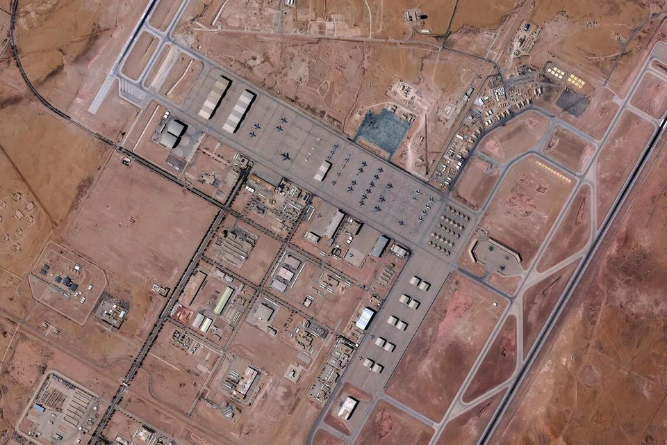
CBS News used Planet Labs imagery to demonstrate that a February 28 strike near a girls’ school in Minab, Iran, also destroyed structures within the compound of a nearby Iranian military base. That kind of analysis - overlaying before-and-after imagery to identify what was hit and what wasn’t - is precisely the capability the blackout eliminates. And it cuts both ways: it prevents adversaries from tracking U.S. and allied military positions, but it also prevents the public from independently evaluating the government’s claims about strike accuracy, civilian casualties, and operational progress.
The OSINT community is already pivoting. ESA’s Sentinel constellation provides free, publicly available imagery, but at 10-meter resolution it’s too coarse for the kind of detailed battle damage assessment that requires distinguishing between a damaged building and an intact one next door. Open-source analysts are reportedly looking at non-U.S. commercial providers - SAR (Synthetic Aperture Radar) firms that can image through clouds and at night, and Asian commercial constellations that operate outside the reach of U.S. licensing authority. But these alternatives are less familiar, lower-resolution in many cases, and significantly harder to access than Planet’s platform, which was designed from the ground up for rapid data delivery.
The Business of Being Told to Be Quiet
Here’s where it gets awkward for Planet Labs. The company went public in December 2021 as a Public Benefit Corporation, a corporate structure that explicitly commits it to considering the interests of stakeholders beyond shareholders - including “the community and society at large.” Its founding pitch was radical transparency: image the entire Earth every day, make that data available, and let sunlight do what sunlight does.
Simultaneously, the company has spent the last two years aggressively pursuing defense and intelligence contracts. Planet received a $12.8 million award from the NGA under the Luno B program for AI-enabled maritime analytics. It was selected as a prime contractor under the Missile Defense Agency’s SHIELD IDIQ, which has a ceiling of $151 billion. It formed a Defense and Intelligence Advisory Board in February 2026. Its Q3 fiscal 2026 earnings call highlighted defense and intelligence as a primary growth driver, with revenue surging 33% year-over-year to a record $81.3 million.
None of this is inherently contradictory. A company can sell data to both the Pentagon and Reuters. But when the Pentagon asks you to stop selling data to Reuters - and your defense contracts represent an increasingly large share of your revenue trajectory - the “public benefit” part of your corporate charter starts to feel more aspirational than operational.
Investors seem unbothered. Planet’s stock (NYSE: PL) rose more than 16% in the days surrounding the blackout announcement, likely driven by the perception that government reliance on commercial imagery firms will deepen as the conflict continues. The market read the blackout not as a restriction on Planet’s business, but as validation of its strategic importance.
What Comes Next
The uncomfortable truth is that none of this is illegal, and most of it probably isn’t even controversial to the people making the decisions. Shutter control has been embedded in U.S. commercial remote sensing law since 1992. Planet Labs agreed to comply with it when it accepted its operating license. The government has the authority to restrict imagery during conflict, and it’s exercised that authority - or its financial equivalent - in every significant U.S. military operation since 2001.
What’s changed is the scale of what’s being withheld and the number of people who’ve come to depend on commercial imagery as a check on government claims. In 2001, commercial satellite imagery was a niche product used by a handful of intelligence firms and news organizations. In 2026, it underpins entire ecosystems of conflict monitoring, humanitarian response, environmental tracking, and investigative journalism. Bellingcat’s head of research has warned that even a two-week delay “slows verification and reduces the certainty investigators can reach while events are still developing.” An indefinite hold compounds that effect dramatically.
The Defense Secretary’s response to concerns about the blackout was blunt: “Open source is not the place to determine what did or did not happen.” It’s a defensible position if you believe operational security always trumps public accountability. It’s a more troubling one if you recall that commercial satellite imagery has been used to expose targeting errors, verify or debunk government narratives, and track humanitarian corridors in every conflict of the last decade.
For now, the satellites keep flying. Planet’s Doves are still collecting imagery over the Middle East - they just aren’t publishing it. The pictures exist. They’re sitting on servers in San Francisco, waiting for someone to decide the war is over and the public interest has been adequately served.
Whether that decision will be made by Planet Labs, by the U.S. government, or by the non-U.S. competitors that are surely watching this moment very carefully, remains an open question.
References(11)
- Planet Labs Imposes Indefinite Blackout on Iran Satellite Imagery at U.S. Request - SatNews
- Satellite firm Planet Labs to indefinitely withhold Iran war images - Reuters via CNBC
- US satellite firm Planet Labs announces blackout on war on Iran images - Al Jazeera
- Satellite companies curb access to Mideast imagery - CBS News
- US Satellite Firm Blacks Out Iran War Images - Antiwar.com
- Military Buys Exclusive Rights to Commercial Satellite Pictures of War Zone - FAS
- U.S. military takes over satellite photos of Afghanistan - Reporters Committee for Freedom of the Press
- Kyl-Bingaman Amendment - Wikipedia
- US says it won't tell space-imagery companies to stop showing Gaza photos - Defense One
- Planet Reports Financial Results for Third Quarter of Fiscal Year 2026 - Business Wire
- How U.S. satellite rules are different only for Israel - NPR

Theodore Kruczek