· deep dive · 14 min read
GOES-19: The Last Weather Sentinel
The final satellite in a multi-billion-dollar program that learned its hardest lesson from a clogged pipe. GOES-19 is now NOAA's eyes on every Atlantic hurricane - and it's already found dozens of comets no one was looking for.
On April 7, 2025, a ten-minute service interruption rippled across NOAA’s weather data network. For precisely those ten minutes, the agency muted the transmitters on GOES-16 - a satellite that had been the operational backbone of American weather forecasting for nearly eight years - and lit up the transmitters on its replacement. When the signal came back, the data flowing to every National Weather Service forecast office, every emergency manager, every airline dispatcher in the Western Hemisphere was coming from GOES-19.
No fanfare. No countdown. Just a switchover timed to avoid an active severe weather event that had already delayed the transition by three days. That’s how you hand off responsibility for a billion people’s weather forecasts - quietly, and only when the skies allow it.
GOES-19 is the fourth and final satellite in NOAA’s GOES-R series, a constellation that has fundamentally reshaped how the United States monitors and predicts weather since the first bird in the series launched in 2016. It’s also the end of the line. After two decades of development, billions in cost overruns, and an embarrassing hardware failure that hobbled one of its siblings, the GOES-R program has delivered its last spacecraft. Whatever comes next - a program called GeoXO, with its first launch targeted for 2032 - will be someone else’s problem to build.
But GOES-19 isn’t just closing out a chapter. Parked at 75.2 degrees west longitude, it carries an instrument that no GOES satellite has ever flown before: a compact coronagraph that’s already rewriting what we know about the near-Sun environment. And in a twist that nobody at NOAA planned for, amateur astronomers have used its data to discover dozens of previously unknown comets.
For a weather satellite, that’s a pretty good side hustle.
GOES-19
activeHalf a Century of Staring at Clouds
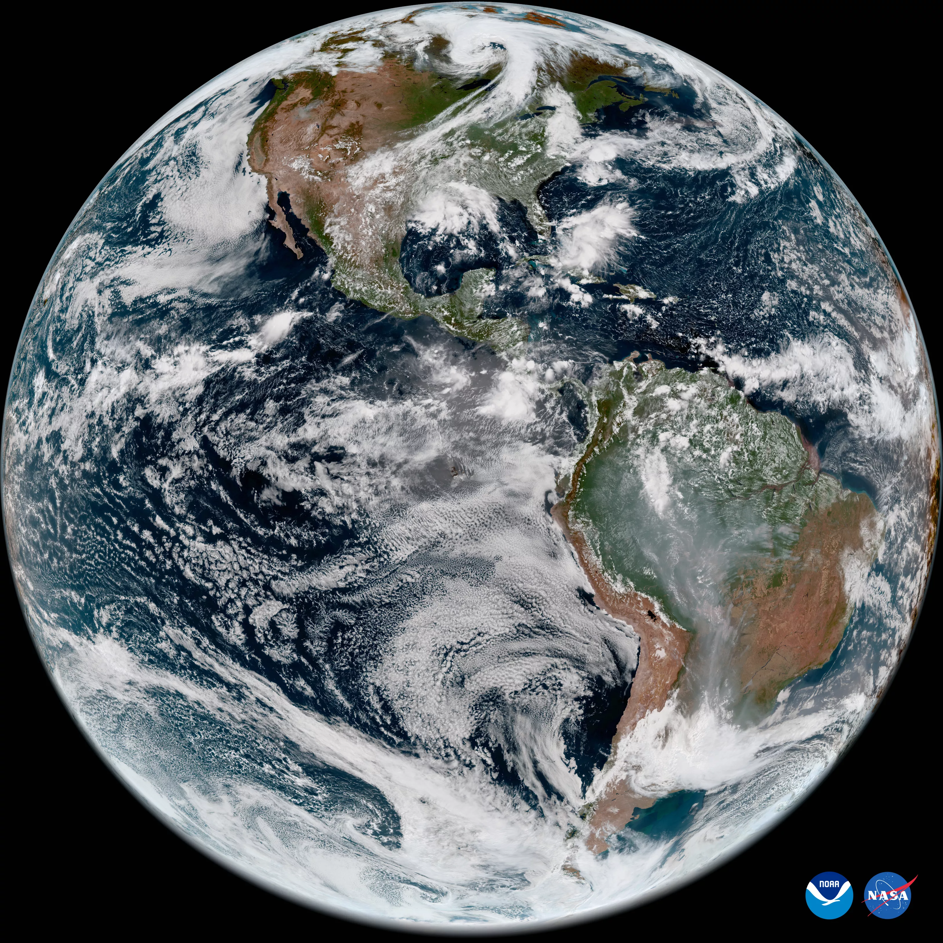
The Geostationary Operational Environmental Satellite program predates the internet, the Space Shuttle, and most of the people who rely on its data every day. The first GOES satellite launched in October 1975, and by modern standards it was barely functional - it could only image the Earth about ten percent of the time. But the core concept was revolutionary: park a satellite 35,786 kilometers above the equator, where its orbital period matches Earth’s rotation, and you get a permanent, unblinking view of weather systems as they develop.
Every generation since has improved on the formula. More spectral bands. Better resolution. Faster scan rates. The GOES-R series, which NOAA and NASA began developing in earnest around 2000, represented the biggest single leap in capability the program had ever attempted. The Advanced Baseline Imager alone provides 16 spectral channels compared to the five on the previous generation, scans four times faster, and delivers four times the spatial resolution. The series also introduced the Geostationary Lightning Mapper, the first operational lightning detector in geostationary orbit.
The ambition came with a price tag to match. The GOES-R program was initially estimated at $6.2 billion for four satellites. By 2006, the Government Accountability Office pegged the likely cost at $11.4 billion. NOAA restructured, cut instruments, and eventually wrestled the budget down to somewhere in the $7-8 billion range - still a staggering sum, but one that bought the most sophisticated geostationary weather observation system ever built.
The four GOES-R satellites were designed to provide continuous coverage into the 2030s, with each satellite carrying enough fuel for five years of orbital storage followed by ten years of operational service. The plan was straightforward: launch them roughly every two years, keep two active (one east, one west) and two in storage as backups. It worked, mostly. But the second satellite in the series nearly derailed the whole program.
The Pipe That Almost Broke the Program
GOES-17 launched in March 2018, and within two and a half months NOAA knew it had a problem. The Advanced Baseline Imager’s cooling system - specifically, the loop heat pipe that transfers waste heat from the instrument’s electronics to a radiator - wasn’t working properly. The LHP was supposed to handle 390 watts of heat. It managed 60, which quickly dropped to 10 or 20.
The consequence was brutal. Without adequate cooling, the ABI’s infrared detectors couldn’t maintain the cryogenic temperatures they needed to function. The focal plane modules heated up, and the infrared channels - the ones most critical for nighttime weather observation - started saturating. At worst, ten of the sixteen spectral channels became partially or fully unusable during certain parts of the orbit, particularly around the equinoxes when solar illumination on the instrument was most intense.
NOAA convened a mishap investigation board. The conclusion: foreign object debris - tiny particulates in the working fluid - had likely blocked the loop heat pipe’s flow. The LHP had been manufactured by Orbital ATK (later absorbed by Northrop Grumman), while the ABI itself was built by what was then Harris Corporation (now L3Harris). The exact source of the contamination was never definitively pinpointed, but the board’s recommendations were clear: redesign the system and switch from propylene to ammonia as the coolant.
This was not an academic problem. All four GOES-R satellites shared the same ABI design. GOES-16, already in orbit, appeared unaffected - it had either gotten lucky with cleanliness or the debris hadn’t migrated to a problematic location. But GOES-T and GOES-U were still on the ground, and their ABIs needed surgery.
Lockheed Martin had already completed assembly of GOES-T when the fix was ordered. Engineers had to pull the ABI out of the finished spacecraft, ship it back to Harris Corporation for a redesign, and then reintegrate it. The process pushed GOES-T’s launch from late 2021 to March 2022. GOES-U, still earlier in its assembly flow, incorporated the fix with less disruption to its schedule.
When GOES-19 finally reached orbit and its ABI powered up in August 2024, the instrument worked exactly as designed. No thermal anomalies. No saturated channels. The redesigned loop heat pipe did its job, quietly rejecting heat into space while the focal plane modules maintained their cryogenic temperatures. For the engineers who had spent years on the fix, the first clean images were vindication.
Launch Day
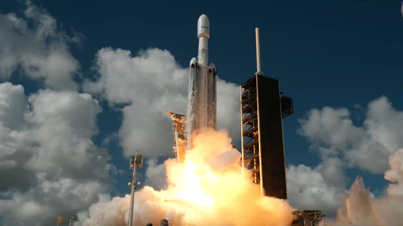
GOES-U launched on June 25, 2024, at 5:26 PM EDT from Launch Complex 39A at Kennedy Space Center - the same pad that sent Apollo astronauts to the Moon and now serves as SpaceX’s primary East Coast launch site. The vehicle was a Falcon Heavy, making GOES-U the first satellite in the GOES program to ride a SpaceX rocket. NASA paid approximately $152.5 million for the launch service.
The choice of Falcon Heavy was practical, not political. GOES satellites are heavy - 5,500 kilograms at launch - and need to reach geostationary transfer orbit, which demands significant performance from the launch vehicle. Previous GOES-R satellites had flown on Atlas V rockets from United Launch Alliance, but Falcon Heavy offered the necessary performance at a competitive price. The two side boosters returned to land at Cape Canaveral after the flight, a visual spectacle that the GOES program managers almost certainly did not include in their mission requirements documents.
Twelve days after launch, GOES-U reached geostationary orbit and was officially redesignated GOES-19 - following the program’s long-standing convention of assigning a letter designation pre-launch and a number once the satellite reaches its operational orbit. The satellite was parked at the checkout location of 89.5 degrees west, roughly between the GOES East and GOES West positions, where it would spend the next nine months being calibrated and validated.
What’s Onboard
GOES-19 carries essentially the same instrument suite as its three predecessors, with one significant addition. The core payload includes the Advanced Baseline Imager for Earth observation, the Geostationary Lightning Mapper for continuous lightning detection, and a suite of space weather instruments: the Solar Ultraviolet Imager (SUVI), the Extreme Ultraviolet and X-ray Irradiance Sensors (EXIS), the Space Environment In-Situ Suite (SEISS) for measuring energetic particles in the magnetosphere, and a magnetometer for monitoring Earth’s magnetic field.
The ABI remains the workhorse. It provides full-disk images of the Western Hemisphere every ten minutes, scans the continental United States every five minutes, and can target two mesoscale domains at one-minute intervals. That last capability is particularly valuable during rapidly evolving events like tornado outbreaks, where half a minute of lead time on a warning can save lives. The sixteen spectral bands span visible through infrared wavelengths, enabling everything from cloud-top temperature measurements to fire detection to sea surface temperature monitoring.
The GLM continuously maps total lightning activity - both cloud-to-cloud and cloud-to-ground - across the hemisphere. Rapid increases in lightning rate are one of the strongest indicators of intensifying thunderstorms, and the GLM data feeds directly into severe weather warning decisions. During its checkout period in late 2024, the GOES-19 GLM tracked lightning in Hurricanes Helene and Milton, detecting the intense outer-band activity associated with Milton’s rapid intensification.
But the genuinely new addition is the Compact Coronagraph-1, or CCOR-1, developed by the U.S. Naval Research Laboratory. It’s the first operational coronagraph ever flown on a NOAA satellite, and it’s there to solve a problem that’s been quietly worrying space weather forecasters for years.
GOES-R Series Satellites
| GOES-16 (2016) | GOES-17 (2018) LHP Issue | GOES-18 (2022) | GOES-19 (2024) Current | |
|---|---|---|---|---|
| Position | On-orbit standby | On-orbit storage (offline) | GOES West (137°W) | GOES East (75.2°W) |
| Launch Vehicle | Atlas V 541 | Atlas V 541 | Atlas V 541 | Falcon Heavy |
| Unique Feature | First GOES-R series | LHP anomaly | Redesigned LHP | First CCOR |
| ABI Status | Nominal | Degraded (94% data) | Nominal | Nominal |
| Coronagraph | No | No | No | CCOR-1 |
- Position
- On-orbit standby
- Launch Vehicle
- Atlas V 541
- Unique Feature
- First GOES-R series
- ABI Status
- Nominal
- Coronagraph
- No
- Position
- On-orbit storage (offline)
- Launch Vehicle
- Atlas V 541
- Unique Feature
- LHP anomaly
- ABI Status
- Degraded (94% data)
- Coronagraph
- No
- Position
- GOES West (137°W)
- Launch Vehicle
- Atlas V 541
- Unique Feature
- Redesigned LHP
- ABI Status
- Nominal
- Coronagraph
- No
- Position
- GOES East (75.2°W)
- Launch Vehicle
- Falcon Heavy
- Unique Feature
- First CCOR
- ABI Status
- Nominal
- Coronagraph
- CCOR-1
The Coronagraph Nobody Expected to Be This Interesting
CCOR-1 exists because SOHO is old. Really old.
The Solar and Heliospheric Observatory, a joint NASA-ESA mission, launched in December 1995. Its LASCO coronagraphs - instruments that create an artificial eclipse by blocking the sun’s bright disk to reveal the faint outer corona - have been the primary tool for detecting coronal mass ejections (CMEs) headed toward Earth for nearly three decades. CMEs are massive eruptions of magnetized plasma from the sun that, if they’re aimed our way, can trigger geomagnetic storms capable of disrupting power grids, satellite operations, GPS navigation, and radio communications.
SOHO has been operating roughly twenty years past its designed lifetime. Every year that it keeps working is a bonus, and every year brings a slightly higher probability of a sudden, unrecoverable failure. If SOHO’s coronagraphs went dark tomorrow, NOAA’s Space Weather Prediction Center would lose its primary source of CME imagery - the data that gives forecasters one to three days of advance warning before a geomagnetic storm hits.
CCOR-1 is the insurance policy. Designed by the Naval Research Laboratory, it’s a compact white-light coronagraph with a field of view spanning from 3.7 to about 17 solar radii. It delivers new images every 15 minutes - a massive improvement over the hours-long delays that sometimes affected LASCO data. Since its activation in September 2024, CCOR-1 has been watching the sun, and NOAA’s space weather forecasters have already been informally incorporating its observations into their work, even before the instrument was officially declared operational.
But CCOR-1 has also become a comet hunter, almost by accident. Coronagraphs routinely catch sungrazing comets - tiny icy bodies on trajectories that bring them within a few solar radii of the sun, where they brighten dramatically before vaporizing. SOHO’s LASCO has discovered over 5,000 comets this way, many of them found by citizen scientists through the Sungrazer Project.
When CCOR-1’s preliminary data became publicly accessible in early 2025, amateur astronomers immediately started looking. Robert Pickard planted the flag on February 11, 2025, finding the first comet in CCOR-1 data. Karl Battams of NRL, lead scientist of the Sungrazer Project, confirmed the find quickly. By May 2025, amateur astronomers had pulled 47 previously unknown sungrazer comets out of CCOR-1 imagery. It’s a testament both to the instrument’s sensitivity and to the persistence of citizen scientists who spend their evenings scanning coronagraph data frame by frame.
Perhaps most remarkably, in October 2025, GOES-19’s CCOR-1 was able to observe 3I/ATLAS - the third confirmed interstellar object to pass through our solar system - as the comet transited near the sun. A weather satellite, designed to track hurricanes and thunderstorms, capturing data on an object that originated outside our solar system billions of years ago. Nobody put that in the mission requirements document either.
Launch
GOES-U lifts off on Falcon Heavy from Kennedy Space Center LC-39A at 21:26 UTC
Geostationary Orbit Reached
GOES-U arrives at GEO and is redesignated GOES-19, parked at 89.5°W checkout position
First Images Released
NOAA shares first ABI imagery of the Western Hemisphere, captured August 30
CCOR-1 First Light
Compact Coronagraph captures first images of coronal mass ejections
SUVI Begins Solar Observations
Solar Ultraviolet Imager activated to monitor the sun in extreme ultraviolet
Handover to NOAA
NASA transfers operational control of GOES-19 to NOAA's Office of Satellite and Product Operations
First CCOR-1 Comet Discovery
Amateur astronomer Robert Pickard identifies first previously unknown comet in CCOR-1 data
Operational as GOES East
GOES-19 replaces GOES-16 at 75.2°W, becoming NOAA's primary Eastern Hemisphere weather satellite
A Unique Vantage Point
One of CCOR-1’s more surprising features stems from something that’s normally considered a limitation. Unlike SOHO and STEREO, which observe the sun from deep space - SOHO sits at the L1 Lagrange point 1.5 million kilometers from Earth, well beyond the Moon’s orbit - CCOR-1 rides on a geostationary satellite relatively close to home. That proximity means the Earth and Moon regularly intrude on its field of view.
Twice a day, Earth “photobombs” the coronagraph. Sunlight reflected off oceans, clouds, and ice - a phenomenon called earthshine - creates a bright flash in the imagery, particularly during sunrise hours. Around the equinoxes, when the geometry is most extreme, Earth can actually eclipse the sun from CCOR-1’s perspective. And during those equinox eclipses, the instrument is sensitive enough to pick up something unexpected: city lights on the nightside of Earth, visible as faint patterns in the difference images.
The Moon makes regular appearances too. Because GOES-19 orbits well inside the lunar orbit, the Moon traces curved and sometimes looping paths through CCOR-1’s field of view as the combined orbital motions create complex apparent trajectories. These are artifacts from CCOR-1’s perspective, but they’re also beautiful demonstrations of orbital mechanics in action.
None of this compromises the instrument’s primary mission of CME detection. The NRL team designed CCOR-1 to handle these effects, and the forecasters at SWPC have learned to read the data around them. But it does make GOES-19’s coronagraph unlike any other space-based sun-watcher currently operating.
What Comes After
GOES-19 is designed for 15 years of service - five in orbital storage and ten operational. Given that GOES-16 is now available as a backup at 105 degrees west, NOAA has comfortable redundancy for its Eastern Hemisphere coverage. GOES-18 continues operating as GOES West at 137 degrees west, covering the Pacific. Together, the pair watches more than half the globe.
But GOES-19 is also, definitively, the last of its kind. NOAA’s next-generation geostationary program, the Geostationary Extended Observations (GeoXO) system, is already in development, with the first satellite planned for launch in 2032 and a second following in 2035. GeoXO will improve on GOES-R’s imaging capabilities with better resolution and more spectral channels, add hyperspectral infrared sounding for improved forecasting, and introduce entirely new instruments including an ocean color sensor for monitoring coastal water quality and an atmospheric composition instrument for tracking air pollutants.
One thing GeoXO will not carry: space weather instruments. Unlike the GOES-R series, the GeoXO satellites won’t include coronagraphs, particle detectors, or solar imagers. That responsibility is shifting to dedicated missions like the Space Weather Follow On at L1 (SWFO-L1, now SOLAR-1), which will carry CCOR-2 - a nearly identical sibling to GOES-19’s CCOR-1 - in a heliocentric orbit at the L1 Lagrange point. A third coronagraph, CCOR-3, is planned for ESA’s Vigil spacecraft at the L5 Lagrange point, with launch targeted for 2031.
The GOES program’s 50th anniversary, which NOAA celebrated in 2025, is a useful reminder of how far weather observation from geostationary orbit has come. The first GOES satellite could image the Earth ten percent of the time with a single spectral band. GOES-19 provides continuous 16-band imagery every ten minutes, maps lightning in real time, monitors solar eruptions with a coronagraph, measures energetic particles in the magnetosphere, and occasionally discovers comets from other star systems.
For the roughly one billion people who live in the Western Hemisphere, GOES-19 is the primary eye in the sky for every hurricane season, every tornado outbreak, every atmospheric river, every wildfire, and every geomagnetic storm between now and the mid-2030s. That’s a lot of responsibility for a 5,500-kilogram box sitting 35,787 kilometers above the equator.
It seems to be handling it fine.
References(14)
- GOES-19 Transition to Operations - GOES-R Program Office
- NOAA's GOES-19 Satellite Now Operational - NOAA Press Release
- GOES-19 First Imagery - NESDIS
- CCOR-1 Compact Coronagraph - Naval Research Laboratory
- GOES-17 ABI Performance and Loop Heat Pipe Anomaly - GOES-R Program
- Amateur Comet Discoveries in GOES-19 CCOR-1 Data - Sky Hunt Blog
- CCOR-1 Coronagraph Experimental Data - NOAA Space Weather Prediction Center
- GOES-17 Instrument Problem Investigation - SpaceNews
- NASA Awards GOES-U Launch Services Contract
- GeoXO Satellite System Overview - NESDIS
- NOAA's GOES-U Satellite One Year Later - NESDIS
- GOES-R Series Overview - NOAA/NASA
- Earth Makes Appearances in GOES-19 CCOR-1 Imagery - SWPC
- NOAA Releases CCOR-1 Coronagraph Data to Public - NESDIS

Theodore Kruczek