· space terms · 7 min read
Geostationary Transfer Orbit
The highly elliptical handoff lane that rockets use to deliver satellites to geostationary altitude, a narrow sliver of orbital space where every communications satellite you've ever seen spends its first few weeks of life.
Picture a long-distance mover trying to deliver a piano to the 60th floor of a skyscraper. They can’t drive the truck up the elevator. What they can do is park the truck in the lobby, unload the piano onto a cart, and wheel it to an elevator that will do the vertical lift. The truck provides the horizontal transport. The elevator does the altitude change. The piano only ends up at its destination when both systems work in sequence.
A geostationary transfer orbit (GTO) is the “truck to the lobby” part of delivering a satellite to geostationary altitude. It is a highly elliptical orbit that carries a satellite from low altitude up to the vicinity of GEO, where the satellite’s onboard propulsion then circularizes the orbit and moves into its final geostationary slot. Every television broadcast satellite, every large weather satellite, every commercial GEO communications satellite in history has passed through a GTO on its way to its operational home.
The Technical Bits
A geostationary orbit sits at an altitude of 35,786 km directly above Earth’s equator, where a satellite’s orbital period exactly matches Earth’s rotation. Getting there from a launch site requires two things: raising the satellite’s altitude by roughly 35,000 kilometers, and adjusting its orbital inclination to match the equator.
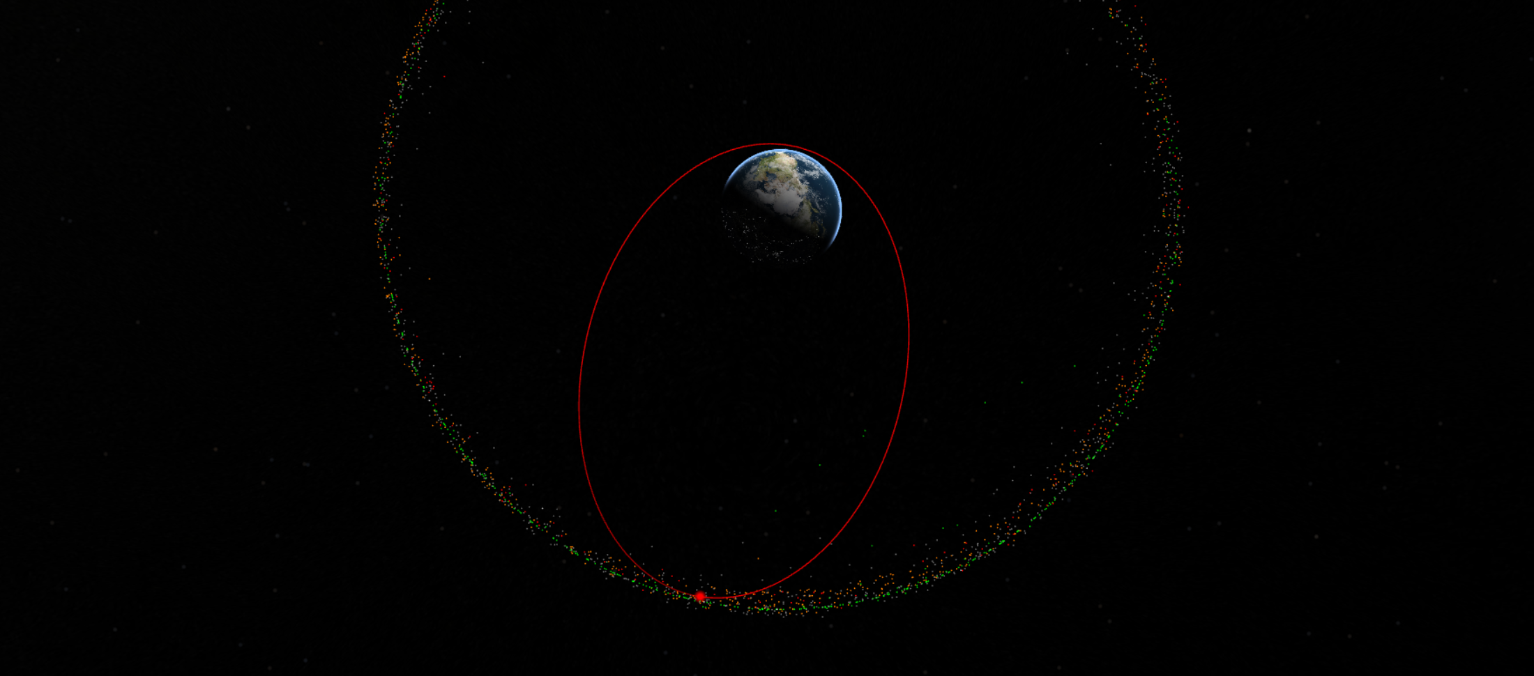
A geostationary transfer orbit handles the first task. A typical GTO has its perigee (low point) between 200 and 650 km altitude and its apogee (high point) at or near geostationary altitude. The satellite rides the rocket to perigee, separates from the upper stage, and coasts through a transfer orbit that takes roughly 10-11 hours from perigee to apogee and back.
At apogee, the satellite’s own propulsion system fires to raise the perigee up to geostationary altitude, circularizing the orbit. This final maneuver is called the apogee kick, and it historically required a dedicated “apogee kick motor” - sometimes a solid rocket embedded in the satellite, sometimes a liquid bipropellant system. Modern satellites often perform the circularization over multiple passes at apogee, using efficient low-thrust engines rather than a single large burn.
The launch vehicle’s performance is usually quoted in “kg to GTO” as a basic capability metric. Falcon 9 can lift about 8,300 kg to GTO in expendable mode, or roughly 5,500 kg if the first stage is recovered. Ariane 6 is designed to lift around 11,500 kg to GTO. Long March 5 can handle 14,000 kg. These numbers matter because they set the maximum mass of a geostationary satellite that each vehicle can launch.
The Supersynchronous Variant
Some missions use a “supersynchronous” transfer orbit where the apogee extends well beyond GEO altitude, sometimes out to 60,000 km or more. This sounds wasteful, but it actually saves propellant in a counterintuitive way. When you perform an inclination change, the amount of delta-V required depends on the magnitude of your velocity vector. A satellite at a very high apogee is moving slowly, so the inclination-change burn there is efficient. The satellite then does a small apogee-lowering burn to come back down to GEO altitude.
This is called the Oberth-efficient technique, and it is used when a mission’s inclination change is large - for example, when launching from a high-latitude site like Baikonur or Xichang to a final equatorial orbit. The satellite pays a small apogee-raising penalty early to save a large inclination-change penalty later. Arianespace does it routinely with Ariane 5 and Ariane 6.
Why It Matters
GTO is the gateway to geostationary orbit, and for most of the history of commercial satellites, geostationary orbit was where the money was. Direct broadcast television, GEO internet, weather imaging, defense communications, and missile warning all lived at 35,786 km altitude. The economics of launch services were measured by the kilogram to GTO for decades, and rocket designs were tuned for this specific destination.
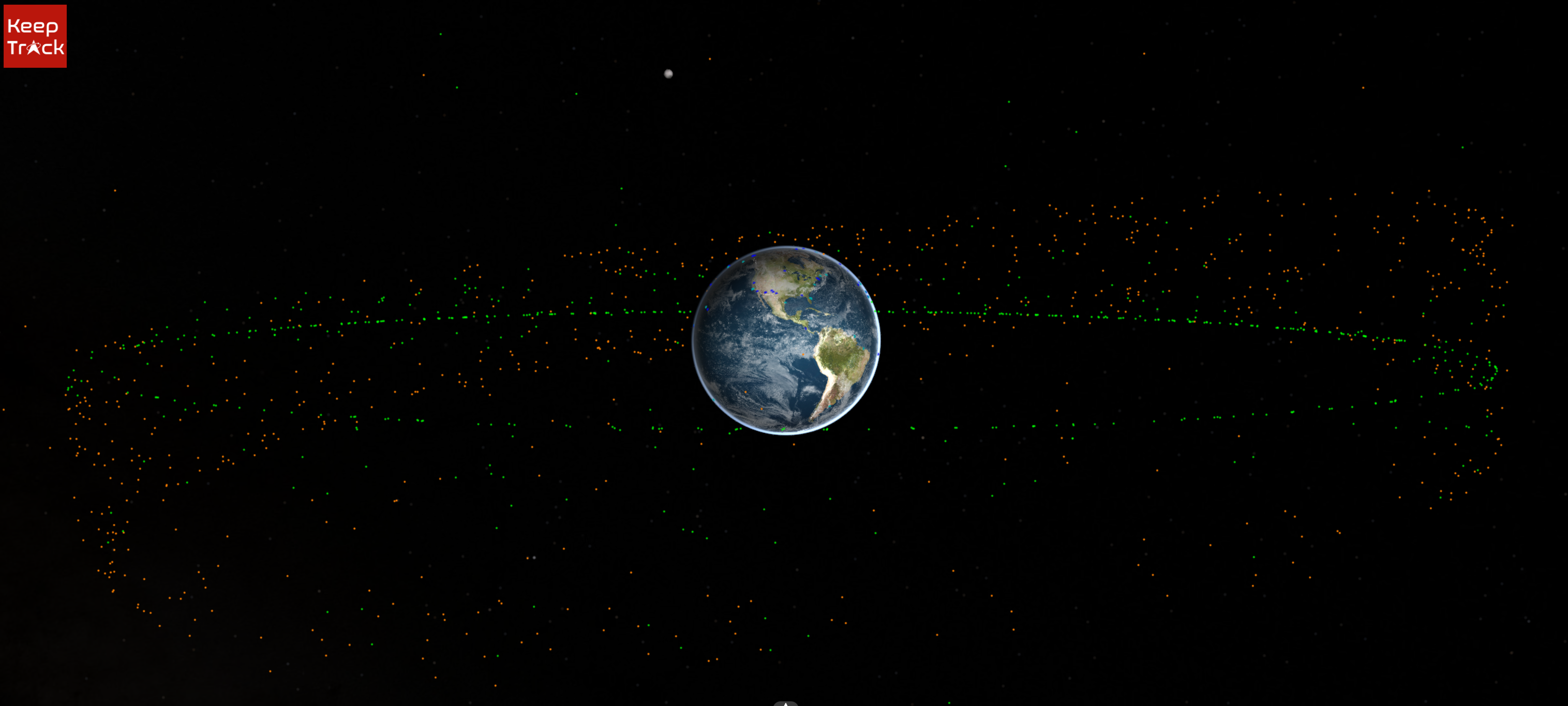
GTO is also a distinctive orbital regime in its own right. Satellites in GTO spend several hours per orbit at high altitude, transit through the Van Allen radiation belts twice per orbit, and produce visible spectroscopic signatures that make them easy for ground-based telescopes to observe. The operational GTO regime is heavily tracked by the U.S. Space Surveillance Network and by commercial SSA providers, because rockets sometimes leave upper stages in GTO that can pose collision risks for years.
The practical consequence is that GTO has become a well-characterized part of the orbital catalog. NORAD tracks approximately 2,000 objects in GTO or nearby elliptical orbits at any given time, most of them upper stages and decommissioned satellites drifting through the Van Allen belts.
The Tradeoffs
GTO is expensive. The eccentricity means the satellite transitions through extreme environments - from a few hundred kilometers where atmospheric drag matters, through the Van Allen belts where radiation is intense, out to GEO where cryogenic radiation from space dominates thermal loads. Satellites designed for GEO service must be hardened against radiation exposure during GTO transits, and they must have enough propellant and thermal control to survive the coasting phase.
Launch vehicle performance also penalizes GTO delivery. Reaching GTO from a launch site not on the equator requires an additional inclination change - launch from Cape Canaveral at 28.5 degrees latitude imposes a significant dogleg to reach the 0-degree GEO plane. Launch from Baikonur at 46 degrees or from Tanegashima at 30 degrees imposes even more. This is part of why the European Ariane program has historically flown from the equatorial ELA-3 site at Kourou: it minimizes the inclination change and maximizes the payload to GTO.
The arrival at GEO has also gotten harder over time. GEO is crowded. The International Telecommunication Union has allocated roughly 1,800 geostationary longitude slots, each with limits on adjacent-slot interference. New GEO satellites must coordinate with nearby operators to avoid frequency collisions. A satellite arriving at the wrong slot, or drifting into a neighbor’s longitude, can cause months of diplomatic and technical disputes.
Fun Fact Space Nerds Might Not Know
The Hughes Aircraft Company invented the “apogee kick motor” concept in the early 1960s as the enabling technology for commercial geostationary satellites. Syncom 3, launched in August 1964, was the first satellite to use one - a solid rocket motor built into the satellite itself, providing the final burn that transformed a transfer orbit into a geostationary orbit. The concept was so successful that Syncom-derived “Hughes 376” satellites became the workhorse GEO platform of the 1970s and 1980s, with over 80 flown.
Without Hughes’s apogee kick motor innovation, commercial communications satellites as we know them would not exist. Direct-to-home television, GEO-based telephony, and modern GEO weather satellites all rest on the architectural decision that the satellite, not the rocket, performs the final circularization burn.
Looking Forward
GTO’s importance is evolving but not diminishing. Geostationary orbit remains the most valuable real estate in space for large-footprint, high-power, single-satellite missions - weather (GOES, Himawari, MTG), defense (AEHF, WGS), direct broadcast (DirecTV, EchoStar), and regional telecommunications (Viasat GEO, ARSAT). These markets are still growing, and the next generation of large GEO satellites (400-600 megabit per second throughputs per payload) is still being ordered.
What is changing is the launch architecture. SpaceX now regularly delivers commercial payloads to GTO as rideshare payloads on dedicated Falcon 9 launches. Soft-landing reusable boosters have made GTO missions less expensive per kilogram than they were a decade ago. Commercial all-electric propulsion satellites now spend up to six months climbing from GTO to GEO using Hall-effect thrusters, which requires less launch performance but more patience from operators.
For KeepTrack users, GTO satellites and upper stages are among the most visually dramatic objects in the catalog. Zoom into any elliptical orbit that stretches from a few hundred kilometers at perigee out to nearly 36,000 km at apogee, with a period of roughly 10-11 hours, and you are looking at either a satellite preparing to circularize at GEO or an upper stage that has been left in a transfer orbit. The traffic through this particular slice of space is continuous, high-value, and mostly unseen by anyone outside the SSA community.
References(5)

Theodore Kruczek